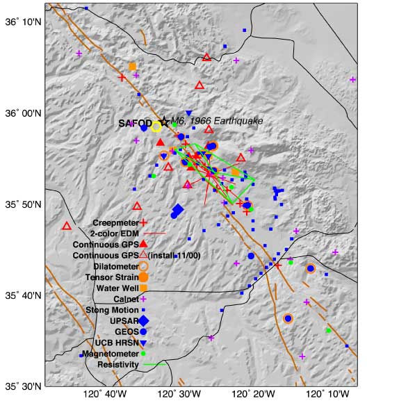
The geophysical instruments operated at Parkfield by the USGS and its collaborators are designed to monitor tectonic processes leading up to the expected earthquake and to record the strong shaking and crustal deformation that will result from it. Because the anticipated earthquake is expected to resemble historic Parkfield earthquakes, especially the 1966 event, data from previous shocks were used to guide the design of the monitoring networks. For example, the rupture zone of the 1966 earthquake and the locations of the 1966 hypocenter and 1934 and 1966 foreshocks near the rupture zone's north end are areas of intense monitoring. Some monitoring efforts have been discontinued, but most are currently operating.
Parkfield Monitoring Networks
Summary Table
Details on instruments and measurements.
Seismic Networks
NCSN, HRSN, strong motion, accelerometer and GEOS.
Deformation Networks
Creep, strain, tilt, GPS, EDM, tilt and water well levels.
Electromagnetic Networks
Magnetometers, magnetotelluric, ULF, resistivity and radio frequency emission.
Discontinued Monitoring
Since the inception of the Experiment some monitoring has been discontinued.
Monitoring networks in the Parkfield area.
- EDM: Electronic Distance Measuring System
- GEOS: General Earthquake Observation System
- GPS: Global Positioning System
- HRSN: High-resolution Seismic Network
- NCSN: Northern California Seismic Network
- ULF: Ultra-low frequency
- UPSAR: USGS Parkfield Dense Seismic Array