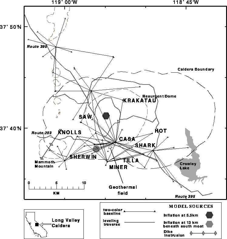
The two-color EDM network near Mammoth Lakes, California is within the Long Valley caldera and has had recent volcanic unrest. The Long Valley Caldera is located east of the Sierra Nevada mountains.
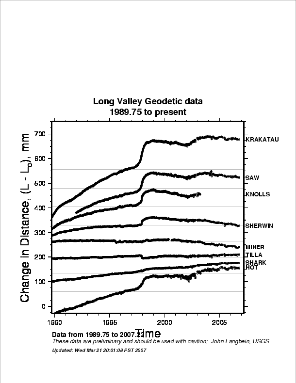
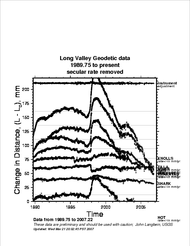
Plots of the changes in length of 8 frequently measured baselines are available through the links listed below. These baselines, which use the central station at CASA as a common end point, have been measured approximately 3 times each week since early 1984. The general trend of the data is: 1) a general decrease in the rate of extension from 1983 through most of 1989; 2) an abrupt increase in the rate of extension on several baselines to 5 cm/yr from late 1989 through early 1990; and 3) a decrease to 2 to 3 cm/yr extension rate that has persisted since mid-1990.
EDM Data
- Plot of measurements, 1983–2005
- Plot of measurements, 1989.75–2005
- Plot of measurements, 1989.75–2005; secular trend removed
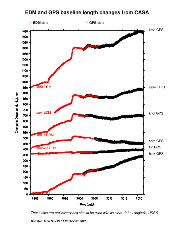
Combination EDM and GPS line-length changes from 1984
The twocolor EDM has been replaced by continuous GPS. Many of the GPS sites are co-located with the EDM sites. Consequently, the length changes that had been monitored with the EDM are now being monitored with GPS. Below are plots of the continuation of the EDM time series using both the older EDM data and the newer GPS data.
- Plot of data from 1984 to 2022
For more details contact: John Langbein