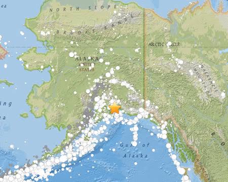
On March 27, 1964 at 5:36pm local time, a M9.2 earthquake rocked the Prince William Sound region of Alaska. This earthquake and ensuing tsunami took 131 lives (tsunami 122, earthquake 9), and caused about $2.3 billion in property loss (in 2013 dollars; equivalent to $311 million in 1964). Earthquake effects were heavy in many towns, including Anchorage, Chitina, Glennallen, Homer, Hope, Kasilof, Kenai, Kodiak, Moose Pass, Portage, Seldovia, Seward, Sterling, Valdez, Wasilla, and Whittier.
Anchorage, about 120 kilometers northwest of the epicenter, sustained the most severe damage to property. About 30 blocks of dwellings and commercial buildings were damaged or destroyed in the downtown area. The J.C. Penney Company building was damaged beyond repair; the Four Seasons apartment building, a new six-story structure, collapsed; and many other multistory buildings were damaged heavily. The schools in Anchorage were almost devastated. The Government Hill Grade School, sitting astride a huge landslide, was almost a total loss. Anchorage High School and Denali Grade School were damaged severely. Duration of the shock was estimated at 3 minutes.
Landslides in Anchorage caused heavy damage. Huge slides occurred in the downtown business section, at Government Hill, and at Turnagain Heights. The largest and most devastating landslide occurred at Turnagain Heights. An area of about 130 acres was devastated by displacements that broke the ground into many deranged blocks that were collapsed and tilted at all angles. This slide destroyed about 75 private houses. Water mains and gas, sewer, telephone, and electrical systems were disrupted throughout the area.
The earthquake was accompanied by vertical displacement over an area of about 520,000 square kilometers. The major area of uplift trended northeast from southern Kodiak Island to Price William Sound and trended east-west to the east of the sound. Vertical displacements ranged from about 11.5 meters of uplift to 2.3 meters of subsidence relative to sea level. Off the southwest end of Montague Island, there was absolute vertical displacement of about 13 - 15 meters. Uplift also occurred along the extreme southeast coast of Kodiak Island, Sitkalidak Island, and over part or all of Sitkinak Island. This zone of subsidence covered about 285,000 square kilometers, including the north and west parts of Prince William Sound, the west part of the Chugach Mountains, most of Kenai Peninsula, and almost all the Kodiak Island group.
This shock generated a tsunami that devastated many towns along the Gulf of Alaska, and left serious damage at Alberni and Port Alberni, Canada, along the West Coast of the United States (15 killed), and in Hawaii. The maximum wave height recorded was 67 meters at Valdez Inlet. Seiche action in rivers, lakes, bayous, and protected harbors and waterways along the Gulf Coast of Louisiana and Texas caused minor damage. It was also recorded on tide gages in Cuba and Puerto Rico.
This earthquake was felt over a large area of Alaska and in parts of western Yukon Territory and British Columbia, Canada.
Abridged from Seismicity of the United States, 1568-1989 (Revised), by Carl W. Stover and Jerry L. Coffman, U.S. Geological Survey Professional Paper 1527, United States Government Printing Office, Washington: 1993.