

M 5.5 - 137 km W of Faras?n, Saudi Arabia
- 2013-07-08 15:30:28 (UTC)
- 16.707°N 40.831°E
- 10.5 km depth
Interactive Map Regional Information Felt Report - Tell Us! 000000Responses Contribute to citizen science. Please tell us about your experience.
- ShakeMap
Vmmi 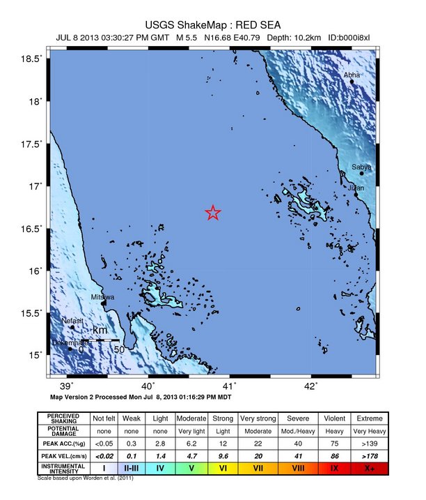
Estimated Intensity Map - PAGER
GREEN 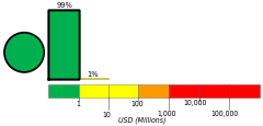
Estimated Economic Losses 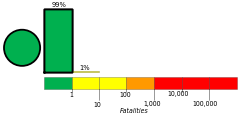
Estimated Fatalities Origin - Review Status
- REVIEWED
- Magnitude
- 5.5 mwb
- Depth
- 10.5 km
- Time
- 2013-07-08 15:30:28 UTC
Moment Tensor Fault Plane Solution View Nearby Seismicity - Time Range

± Three Weeks - Search Radius

250.0 km - Magnitude Range

≥ 2.0
Contributors US

USGS National Earthquake Information Center, PDE