

M 2.2 - 3 km SE of McConnell AFB, Kansas
- 2021-04-02 05:39:34 (UTC)
- 37.608°N 97.224°W
- 4.9 km depth
Interactive Map Regional Information Felt Report - Tell Us! 000018Responses Contribute to citizen science. Please tell us about your experience.
- Did You Feel It?
IVmmi 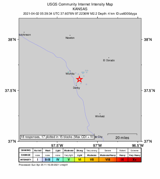
Community Internet Intensity Map Origin - Review Status
- REVIEWED
- Magnitude
- 2.2 mb_lg
- Depth
- 4.9 km
- Time
- 2021-04-02 05:39:34 UTC
View Nearby Seismicity - Time Range

± Three Weeks - Search Radius

250.0 km - Magnitude Range

≥ 1.0
Contributors US

USGS National Earthquake Information Center, PDE