

M 5.3 - off the coast of Oregon
- 2019-06-22 12:52:01 (UTC)
- 43.767°N 128.402°W
- 10.0 km depth
Interactive Map Regional Information Felt Report - Tell Us! 000005Responses Contribute to citizen science. Please tell us about your experience.
- Did You Feel It?
IIImmi 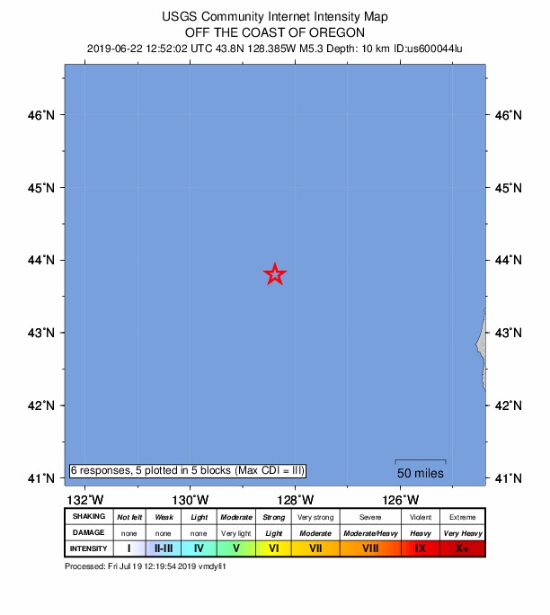
Community Internet Intensity Map - ShakeMap
N/Ammi 
Estimated Intensity Map - PAGER
GREEN 
Estimated Economic Losses 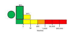
Estimated Fatalities Origin - Review Status
- REVIEWED
- Magnitude
- 5.3 mww
- Depth
- 10.0 km
- Time
- 2019-06-22 12:52:01 UTC
Moment Tensor Fault Plane Solution Tsunami 
U.S. Tsunami Warning System To view any current tsunami advisories for this and other events please visit https://www.tsunami.gov.
View Nearby Seismicity - Time Range

± Three Weeks - Search Radius

250.0 km - Magnitude Range

≥ 2.0
Contributors US

USGS National Earthquake Information Center, PDE