Fault Slip Rates
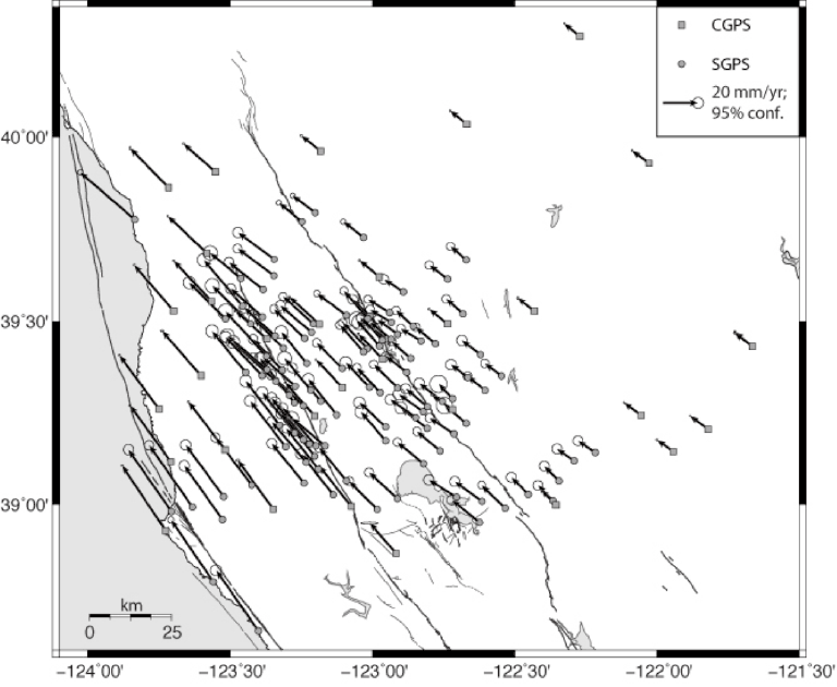
Earth’s crust typically moves a few millimeters to centimeters per year. In an actively deforming continental region, the crust often behaves like a set of nearly-rigid blocks separated by faults. The velocity within a block is nearly constant, but the velocity may differ substantially from one block to an adjacent one. Whether the transition in velocity across a bounding fault is abrupt or gradual depends on whether the fault is creeping (abrupt transition) or locked (gradual transition). The distinction is important because a gradual transition implies not only that the fault is locked but that it is accumulating stress that will eventually lead to earthquakes.
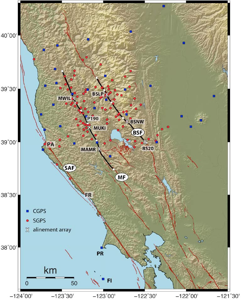
An example is the horizontal crustal deformation field in the northern San Francisco Bay area. The crust is approximated as three blocks, their boundaries lying along the right-lateral strike-slip San Andreas fault, Macaama fault, and Bartlett Springs fault. Motions across the San Andreas fault, southern Macaama fault, and southern Bartlett Springs fault are gradual, but those across the northern Macaama fault and northern Bartlett Springs fault are abrupt in several areas, implying some degree of fault creep.
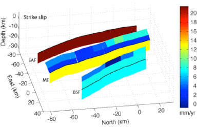
A recent study by Murray, Minson, and Svarc employs use a Bayesian technique to interpret the GPS crustal velocity field to estimate deep slip rates and shallow surface creep. Their model indicates a deep slip rate of 20 mm/yr for the San Andreas fault, a deep slip rate of 13 mm/yr and shallow creep rate of 0 to 13 mm/yr on the Maacama fault, and a deep slip rate of 7 mm/yr and shallow creep rate of 0 to 7 mm/yr along the Bartlett Springs fault.
Reference
- Murray, J.R., Minson, S., and Svarc, J., Slip rates and spatially variable creep on faults of the northern San Andreas system inferred through Baysian inversion, J. Geophys. Res., submitted. (2014).