U.S. flag

An official website of the United States government

Earthquake Hazards Program

The USGS monitors and reports on earthquakes, assesses earthquake impacts and hazards, and conducts targeted research on the causes and effects of earthquakes. We undertake these activities as part of the larger National Earthquake Hazards Reduction Program (NEHRP), a four-agency partnership established by Congress.

News

The Night the Earth Shook

The Night the Earth Shook

(Some) Assembly Required: How to sign your organization up for the Great ShakeOut

(Some) Assembly Required: How to sign your organization up for the Great ShakeOut

USGS seeking Loma Prieta felt reports from 35-year-old earthquake

USGS seeking Loma Prieta felt reports from 35-year-old earthquake

Publications

Macroseismology

In this chapter I discuss the use of so-called macroseismic data, i.e., reports of damage and other effects of shaking on humans and the built environment, to improve the characterization of earthquakes and the ground motions they produce. Macroseismic data are critical not only to investigate earthquakes that occurred before the start of the instrumental era in seismology, but are also...
Authors
Susan E. Hough

Paleoseismology and paleogeodesy using coral microatolls

Establishing the rupture extent and slip distribution of individual paleo-earthquakes is vital for assessing fault behavior including the persistence of rupture segmentation, recurrence patterns, and similarity of successive events, key issues in both fault mechanics and hazard assessment. Techniques with high temporal and geodetic precision as well as a wide distribution of study sites...
Authors
Belle E. Philibosian

Remote single-station seismic monitoring of the July–October 2022 earthquake swarm at Tau volcano, American Samoa

From July to October 2022, a non-eruptive volcanic earthquake swarm occurred within ~15 km of Taʻū Island, located in eastern American Samoa. Felt reports from local residents were the only available information about the swarm when it started, as American Samoa lacked a seismic monitoring network. We developed a consistent single-station catalog for the entire swarm, using seismic data...
Authors
Clara Yoon, Robert Skoumal, Andrew J. Michael, Arthur D. Jolly, Andria P. Ellis, Drew T. Downs, Peter Dotray, Natalia I. Deligne, Jefferson Chang, Ninfa Lucia Bennington, Aaron Wech, Matthew M. Haney, Alicia J. Hotovec-Ellis, Elinor Lutu-McMoore, Marcus Langkilde

Science

link

Public kickoff webinar: 2026 National Seismic Hazard Models for Guam & Northern Mariana Islands and American Samoa

Monday, February 24, 2025 2:00-4:00 pm MST A Virtual Meeting
Learn More

M 6.9 October 17, 1989 Loma Prieta Earthquake

The 1989 Loma Prieta earthquake ended decades of tranquility in the San Francisco Bay region. It was a wakeup call to prepare for the potentially even more devastating shocks that are inevitable in the future. Since 1989, the work of the U.S. Geological Survey and other organizations has improved understanding of the seismic threat in the Bay region, promoted awareness of earthquake hazards, and...
link

M 6.9 October 17, 1989 Loma Prieta Earthquake

The 1989 Loma Prieta earthquake ended decades of tranquility in the San Francisco Bay region. It was a wakeup call to prepare for the potentially even more devastating shocks that are inevitable in the future. Since 1989, the work of the U.S. Geological Survey and other organizations has improved understanding of the seismic threat in the Bay region, promoted awareness of earthquake hazards, and...
Learn More

Earthquake Response and Investigations

Post-earthquake scientific and engineering investigations are undertaken by the USGS and its partners to capture critical information to understand the causes and impacts of the event, lessons from which can substantially improve the Nation’s resilience after future earthquakes.
link

Earthquake Response and Investigations

Post-earthquake scientific and engineering investigations are undertaken by the USGS and its partners to capture critical information to understand the causes and impacts of the event, lessons from which can substantially improve the Nation’s resilience after future earthquakes.
Learn More

Multimedia

A map of the December 5th, 2024 Earthquake overlaid with decorative images and text Explained: The December 5th, 2024 Earthquake (AD)
Explained: The December 5th, 2024 Earthquake (AD)
An image of the map of the December 5th, 2024 earthquake near Mendocino. The image is overlaid with text and an illustration Explained: The December 5th, 2024 Earthquake
Explained: The December 5th, 2024 Earthquake
4 photos of seismic instruments in a barren room
Seismographs at the Albuquerque Seismological Laboratory
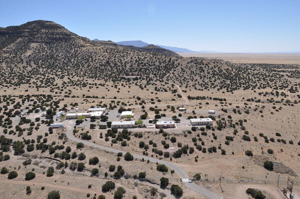
aerial view of desert with a group of buildings and mountains in the background
Aerial View of the Albuquerque Seismological Laboratory
globe with red and green dots
Global Seismographic Network (GSN) Stations
shakeout manual cover page
Cover of fictional Great ShakeOut instruction manual.
shakeout manual page 5
Page 6 of fictional Great ShakeOut instruction manual
shakeout manual page 8
Page 8 of fictional Great ShakeOut instruction manual
shakeout manual page 3
Page 3 of fictional Great ShakeOut instruction manual
Was this page helpful?