The San Andreas fault, which is more than 700 miles (1100 kilometers) in length, is the boundary between the Pacific and North American tectonic plates. The portion of the fault running through the Carrizo Plain National Monument, south of Parkfield (see map) is unique because the surface expression of the fault trace is very well defined. This is because the region is arid and therefore the fault has not been significantly eroded.
These photos were taken using a technique called Kite Aerial Photography (KAP). KAP has a long history, beginning in France in 1889 when Arthur Batut first lifted his camera above Labruguière using a kite. In 1906, George Lawrence flew his panoramic camera above San Francisco to document damage resulting from the great earthquake.
Interactive 360-degree panorama of the San Andreas Fault at Wallace Creek. On January 9, 1857, the M 7.9 Fort Tejon earthquake occurred just north of the Carrizo Plain. Here, at Wallace Creek, the fault moved 30 feet (9m), forming the offset stream channel seen in the photo above. The rupture zone extended nearly 220 mi (350km) from near Parkfield at the northwest end to the vicinity of San Bernardino, east of Los Angeles.
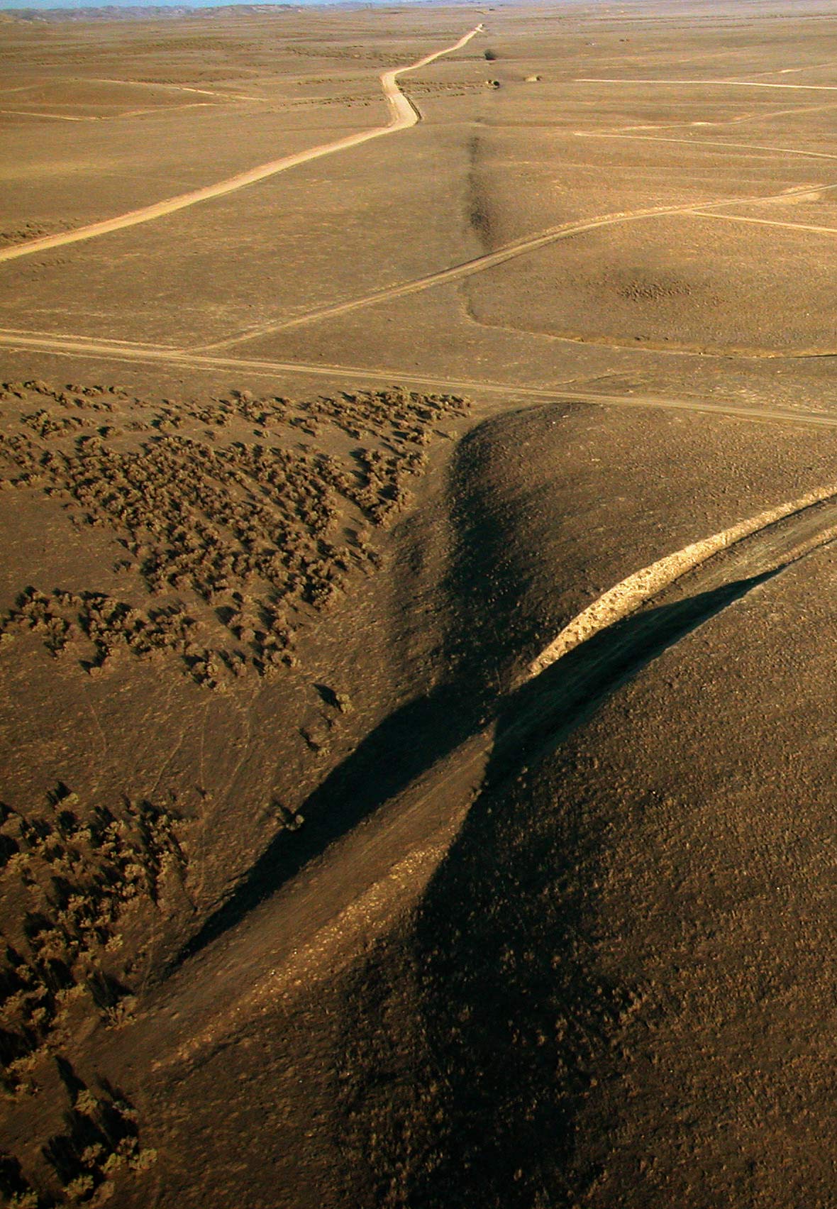
Additional photos depicting the San Andreas Fault in the Carrizo Plain.
- The Sutton Flowform Kite suspends the camera system above the fault.
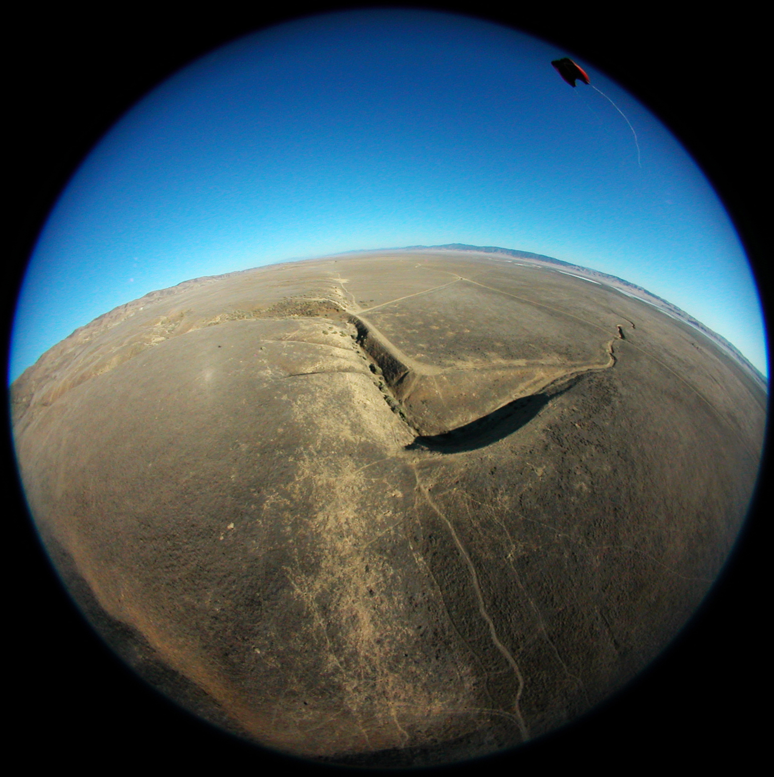
- View looking southeast along the surface trace of the San Andreas fault, north of Wallace Creek. Elkhorn Rd. meets the fault near the top of the photo.
All photos by Scott Haefner, USGS.