Cascadia’s frontal thrust fault system revealed in unprecedented detail
Janet Watt
U.S. Geological Survey

- Date & Time
- Location
- Hybrid seminar in-person & online via Microsoft Teams
- Host
- Ben Brooks
- Summary
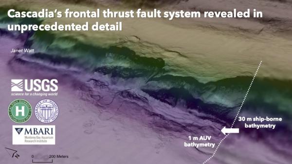
Investigating the geologic record of shallow megathrust behavior is imperative for estimating the earthquake hazard and tsunamigenic potential along the Cascadia subduction zone. Ship-borne sparker seismic imaging and multibeam mapping is integrated with targeted autonomous underwater vehicle (AUV) bathymetry and sub-bottom data to document along-strike variability in seafloor morphology and deformation mode along the Cascadia subduction zone frontal thrust offshore Oregon and northern California in unprecedented detail. The combined use of high- and ultra-high-resolution bathymetric (30-m to 1-m grids) and seismic imaging (vertical resolution ranging from 2 m to centimeters) allows us to evaluate geologic evidence for co-seismic activation of frontal thrust structures. Multi-scale data synthesis enables investigation of linkages between shallow deformation style and deeper decollement structure and accretionary mode.
The ~580-km-long frontal thrust splay fault system between Astoria and Eel Canyons is divided into seven sections based on along-strike variability in shallow structure and seafloor morphology. Many late Pleistocene to Holocene active fault strands within 10 km of the deformation front exhibit both geomorphic and stratigraphic evidence for coseismic activation. The high degree of variability in detailed shallow structure and morphology along the frontal thrust reflects changes in the crustal-scale frontal thrust fault geometry and décollement level. We present a conceptual model that links the along-strike variability in frontal thrust morpho-tectonics to differences in accretionary mode. Results suggest shallow megathrust rupture including co-seismic activation of frontal thrust splay faults is a common rupture mode along much of the Cascadia margin that should be considered in future earthquake and tsunami rupture models and hazard assessments.
Closed captions are typically available a few days after the seminar. To turn them on, press the ‘CC’ button on the video player. For older seminars that don’t have closed captions, please email us, and we will do our best to accommodate your request.
 Jump to Navigation