Integrated Strategies for Enhanced Rapid Shaking and Impact Estimates
David Wald
USGS

- Date & Time
- Location
- Online-only seminar via Microsoft Teams
- Summary
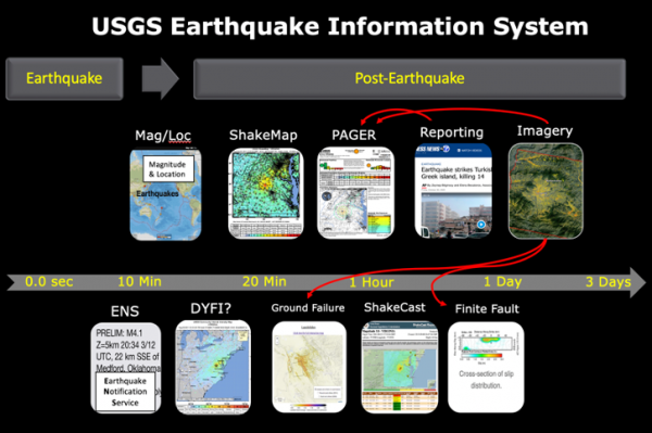
We continue to gradually improve upon the current suite of near-real-time USGS earthquake information systems and products that provide estimates of the shaking distribution, casualties, and economic impacts. These products are, of course, aimed at improving situational awareness, targeted response, disaster financing, and earthquake-engineering forensics. Yet, intriguing technological advances on the horizon might allow us to significantly improve upon our current post-earthquake information content.
Advancements in remote sensing, rapid in-situ impact reporting, and machine learning—combined with new datasets such as global building footprints—allow for innovative data-fusion strategies that integrate with existing models and should greatly improve the accuracy and spatial resolution of our shaking and loss estimates. Essentially, we are trying to fill gaps in our current analyses including (1) the lack of direct incorporation of the contributions of ground failure to loss estimates (currently shaking-based only), (2) variable quality and availability of worldwide building inventories and fragilities, and (3) the inability to rapidly update loss estimates despite readily available “ground-truth” observations.
Our vision is a comprehensive, integrated loss-estimation system that incorporates ground-truth observations and imagery, and computes increasingly accurate losses that converge with reality over time. The next generation PAGER system “g-2 PAGER” will assimilate currently disparate yet complementary efforts that will ultimately result in a more fully integrated, spatially accurate, series of PAGER-related products. My presentation will provide an overview of the status of and science behind these efforts, and outline both the challenges and the strategies we plan to employ to contend with them.
Closed captions are typically available a few days after the seminar. To turn them on, press the ‘CC’ button on the video player. For older seminars that don’t have closed captions, please email us, and we will do our best to accommodate your request.
 Jump to Navigation