Great Sand Dunes National Park, Colorado, USA
US SDCO commences operations on: 2002,192
| Host | – |
|---|---|
| Network | US |
| Latitude | 37.746 |
| Longitude | -105.501 |
| Elevation | 2569 |
| Datalogger | Q330 |
| Broadband | STS-2.5 |
| Accelerometer | Episensor ES-T |
| Telemetry Status at the NEIC | Pending |
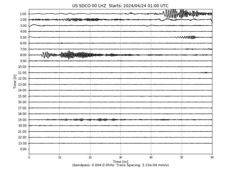
Heliplot
Latency
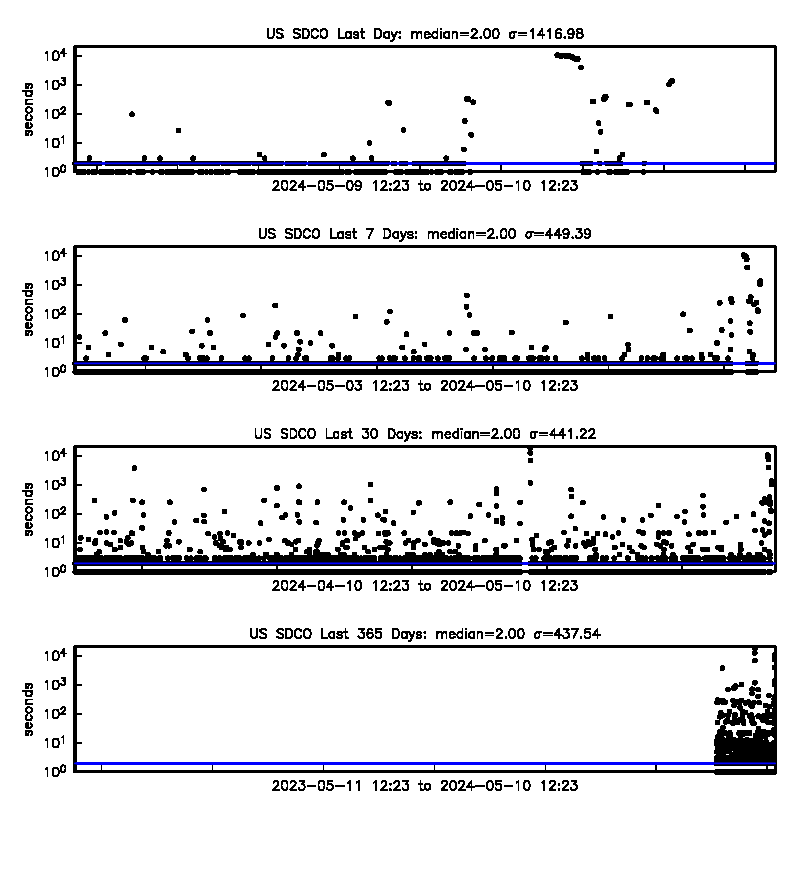
Availability
Past 30 Days

Past 365 Days

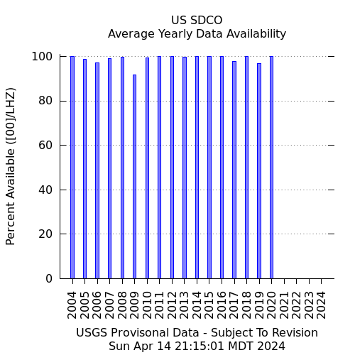
Yearly
Site Geology
Quaternary age alluvial fan deposits consisting of poorly sorted, coarse sand and gravel. Deposited by stream systems along the west side of the Sangre de Cristo Range.