Alum Creek State Park, Ohio, USA
US ACSO commences operations on: 2000,135
| Host | – |
|---|---|
| Network | US |
| Latitude | 40.232 |
| Longitude | -82.982 |
| Elevation | 288 |
| Datalogger | Q330 |
| Broadband | STS-2.5 |
| Accelerometer | Episensor ES-T |
| Telemetry Status at the NEIC | Pending |
Site


Heliplot

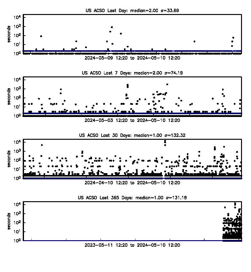
Latency
Availability
Past 30 Days

Past 365 Days

Yearly

Site Geology
The Ohio Shale unit is a bituminous black shale with large concretions and is Devonian in age.