

M 4.2 - 4 km N of Geyserville, California
- 2000-01-18 23:26:01 (UTC)
- 38.752°N 122.914°W
- 6.9 km depth
Interactive Map Regional Information Felt Report - Tell Us! 000000Responses Contribute to citizen science. Please tell us about your experience.
- ShakeMap
IVmmi 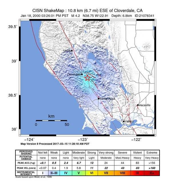
Estimated Intensity Map Origin - Review Status
- REVIEWED
- Magnitude
- 4.2 mw
- Depth
- 6.9 km
- Time
- 2000-01-18 23:26:01 UTC
Moment Tensor Fault Plane Solution View Nearby Seismicity - Time Range

± Three Weeks - Search Radius

250.0 km - Magnitude Range

≥ 1.0
Contributors NC

California Integrated Seismic Network: Northern California Seismic System (UC Berkeley, USGS Menlo Park, and Partners)