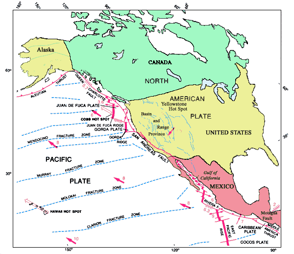
Northeastern Pacific Basin, showing relation of the San Andreas fault as one element in the complex boundary between the North American and Pacific plates. Modified from Drummond (1981).