The 1906 earthquake was the first earthquake in the U.S. to be scientifically studied, and the State Earthquake Investigation Commission (SEIC) published a very thorough and important scientific report, published in 1908 (A.C. Lawson, ed.).
Recent research in historical archives has provided important new insights into the 1906 rupture along the San Andreas, particularly along the San Francisco peninsula and in the Loma Prieta area.
A collection of about 600 glass plate negatives, many unpublished, is in the archives of the Bancroft Library at the University of California, Berkeley. Photographs such as those below, that show the 1906 ground rupture, are being used to map the fault more precisely than has been previously possible through areas that are now developed.
To get an impression of the extent of development in one area compare the scanned 1950 (817K) and 1980 (850K) topo maps, of the San Francisco S quad.
Development in many cases has obliterated the traces of the 1906 rupture, but using old maps and pre-development aerial photographs researchers have been able to locate many of the historic photographs. The photographs are also useful for determining the amount of 1906 offset and the width of the fault zone.
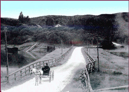
Photograph taken after the 1906 earthquake showing offset of road (road is now highway 92 across Crystal Springs reservoir). Courtesy of Bancroft Library.
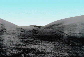
Photograph taken along the San Francisco peninsula after the 1906 earthquake showing 2 distinct fault traces. Courtesy of Bancroft Library.
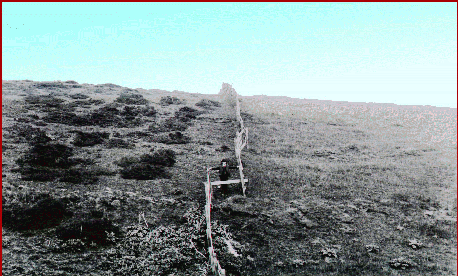
Photograph taken along the San Francisco peninsula after the 1906 earthquake showing 3 distinct fault traces offsetting a fence. This photograph provides an estimate of the total offset. Courtesy of Bancroft Library.
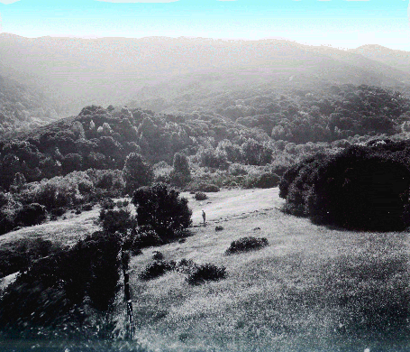
Photograph taken along the San Francisco peninsula after the 1906 earthquake showing fault trace offsetting a fence and tree line between San Andreas Lake and Crystal Springs Reservoir. Both the offset fence and tree line can still be seen today. Courtesy of Bancroft Library.