by Linda Seekins and John Boatwright
We analyzed the directivity for 47 moderate 3.5≤M≤5.4 earthquakes that occurred between 1998 and 2008. View the solutions for these earthquakes.
The map shows the locations of 36 of the earthquakes analyzed: one event near Mammoth Lakes, three events in Humboldt county, and four events near Paso Robles are located outside of the map. The earthquakes discussed in the text are identified. The small dots represent Shakemap recording stations.
Distribution of Rupture Direction and Velocity
The earthquakes we have analyzed for directivity comprise 35 strike-slip earthquakes, 11 thrust earthquakes, and 1 normal-faulting earthquake.
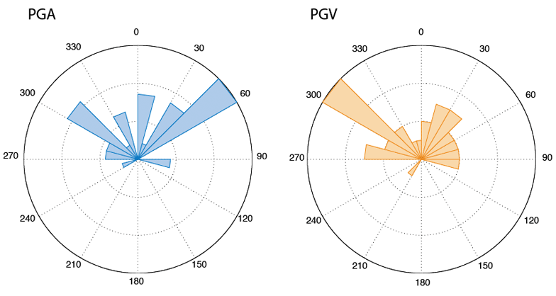
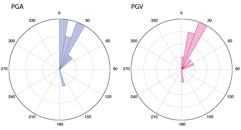
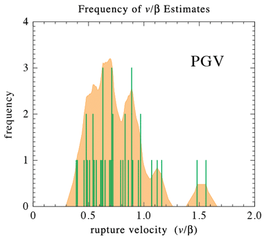
The most striking result of the study is the prevalence of strong directivity in the peak ground motions. The second striking result of this study is the tendency for strike-slip earthquakes to rupture updip.