The PAGER system provides fatality and economic loss impact estimates following significant earthquakes worldwide.
PAGER, Past 7 Days
- YellowM 6.3 - 20 km NE of Esmeraldas, Ecuador2025-04-25 11:44:55 UTCVII
- GreenM 4.2 - 56 km WNW of Petrolia, CA2025-04-24 03:41:46 UTCIII
- OrangeM 6.2 - 21 km SE of Marmara Ereğlisi, Turkey2025-04-23 09:49:10 UTCVIII
- GreenM 4.5 - 6 km N of Willow, Alaska2025-04-23 00:24:51 UTCIV
- GreenM 5.7 - 95 km NNW of Sola, Vanuatu2025-04-22 16:55:33 UTCIII
- GreenM 5.7 - 135 km N of Lae, Papua New Guinea2025-04-22 13:29:11 UTCIII
- GreenM 6.2 - 269 km SE of Pondaguitan, Philippines2025-04-22 10:17:13 UTCIV
- GreenM 5.7 - 141 km SSW of Banjar, Indonesia2025-04-22 10:14:02 UTCIV
- GreenM 5.4 - 152 km WSW of Fakfak, Indonesia2025-04-20 18:19:50 UTCV
- GreenM 5.5 - 92 km NNE of Hihifo, Tonga2025-04-19 16:55:04 UTCIV
- GreenM 5.9 - 39 km SW of Malisbeng, Philippines2025-04-19 16:11:14 UTCV
- GreenM 5.6 - central Mid-Atlantic Ridge2025-04-19 13:50:22 UTCI
- GreenM 4.3 - 20 km W of Beluga, Alaska2025-04-19 07:18:55 UTCIV
- GreenM 5.7 - 63 km SSW of Ashkāsham, Afghanistan2025-04-19 06:47:55 UTCIV
View Map and List of PAGER Events
-
Search PAGER Archives
Explore events that include PAGER. Default search retrieves only events with PAGER products from the past 30 days but can be refined to user specifications.
-
Explore the Science Behind PAGER
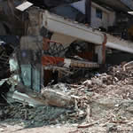
How was the PAGER system created and what is the process for determining PAGER alert levels?
-
Understand PAGER
A graphical guide to reading one-PAGER and two-PAGER products.
-
Discover Related Products
PAGER is one of many products that work together to tell a more complete story. Explore products related to PAGER.