Tracing the 1959 M7.3 Hebgen Lake earthquake sediment record in four nearby lakes, West Yellowstone region, USA
Video not found
Please check back later. Videos are usually posted within 24 hours.
Sylvia Nicovich
USGS

- Date & Time
- Location
- Hybrid In-Person and Online seminar via Microsoft Teams
- Host
- Jessie Vermeer
- Summary
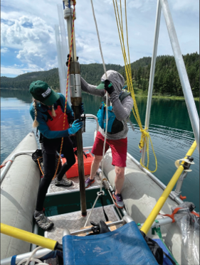
The M7.3 1959 Hebgen Lake earthquake in southwestern Montana is one of the largest earthquakes recorded within the Intermountain West region of the United States. Ground-shaking and hanging-wall subsidence caused an approximately 6-meter-high seiche in Hebgen Lake, liquefaction features in adjacent valleys, a massive landslide that dammed the Madison River to form Earthquake Lake, and increased activity in hydrothermal systems of the Yellowstone caldera. Accordingly, lakes within the southern Madison and eastern Centennial Valleys, ≤25 km from the epicenter, experienced shaking of Modified Mercalli Intensity VI-VII. We characterize how the 1959 earthquake signature is recorded in the stratigraphic record of four lakes in this area that have varying morphometric and hydrologic properties such as depth, shape, surface area, and catchment area. We present data from 24 sediment cores along transects of Wade Lake (9 cores), Cliff Lake (5 cores), Hebgen Lake reservoir (3 cores), and Henry’s Lake (7 cores). Each lake records background sediment consisting of laminated to thinly bedded silt and sand with distinct sedimentary disturbances such as 1) normally graded sand beds, 2) massive, poorly sorted deposits, and 3) macro floral debris, all likely indicators of the 1959 Hebgen earthquake. To test this hypothesis, we use fallout radionuclide 137Cs, where concentrations become measurable after 1954 CE and the maximum value indicates 1963 CE. Preliminary 137Cs concentrations and their locations in Henry’s and Hebgen Lake cores support the interpretation of the disturbance horizons being formed by the 1959 earthquake. Comparing characteristics of the 1959 event deposit in these four lakes will illuminate how differences in lake morphometry or setting may impact lacustrine records of strong ground shaking. Ultimately these observations will help calibrate how Intermountain West lakes record strong shaking and facilitate comparisons to both terrestrial and lacustrine paleoseismic data globally.
Sylvia Nicovich is a Mendenhall Research Fellow at the U.S. Geological Survey Geologic Hazards Science Center in Golden, CO studying lacustrine paleoseismology in the Intermountain West. Prior to her Mendenhall assignment, she conducted paleoseismologic investigations for seismic hazard analysis at the Bureau of Reclamation in Lakewood, CO. Sylvia earned a PhD in Geology from Montana State University in 2020 with a dissertation that focused on alluvial fan geomorphic and sedimentary records. She also holds BS and MS degrees from Cal Poly Humboldt, where she studied active faults in the northern California fold and thrust belt.
 Jump to Navigation