Bozeman, Montana, USA
US BOZ commences operations on: 1999,315
| Host | – |
|---|---|
| Network | US |
| Latitude | 45.597 |
| Longitude | -111.63 |
| Elevation | 1589 |
| Datalogger | Q330 |
| Broadband | STS-2 |
| Accelerometer | Episensor ES-T |
| Telemetry Status at the NEIC | Pending |
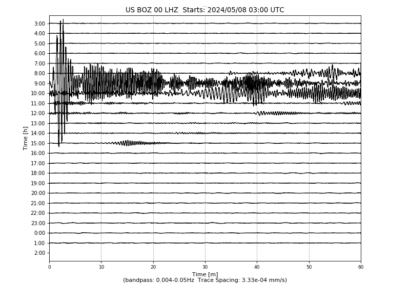
Heliplot
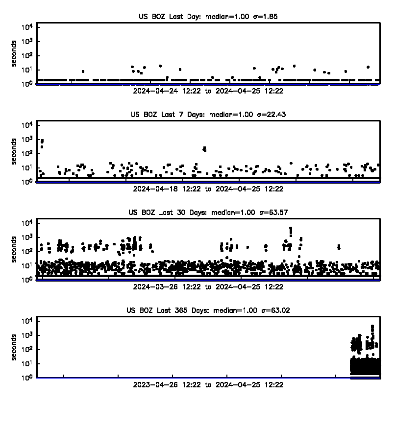
Latency
Availability
Past 30 Days

Past 365 Days

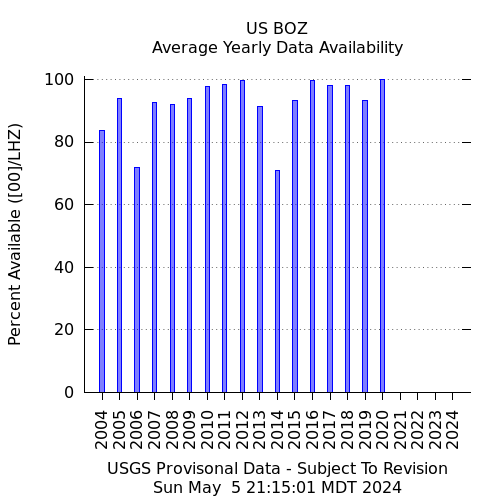
Yearly
Site Geology
Seated in a plagioclase-microcline-quartz-biotie (granitic) gneiss which is Archean in age. Weakely to moderately foliated.