

M 3.8 - 12km NE of Trabuco Canyon, CA
- 2007-09-12 11:30:25 (UTC)
- 33.731°N 117.483°W
- 10.6 km depth
Interactive Map Regional Information Felt Report - Tell Us! 001915Responses Contribute to citizen science. Please tell us about your experience.
- Did You Feel It?
IIImmi 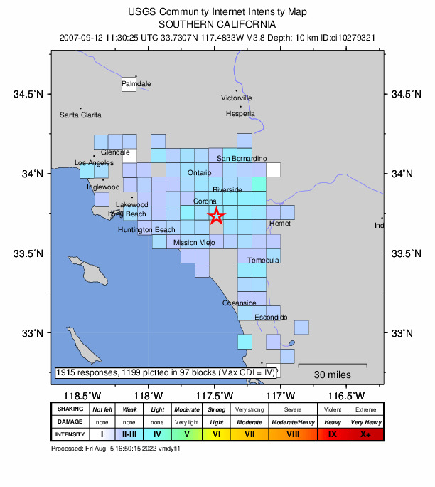
Community Internet Intensity Map - ShakeMap
Vmmi 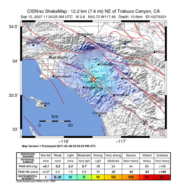
Estimated Intensity Map Origin - Review Status
- REVIEWED
- Magnitude
- 3.8 ml
- Depth
- 10.6 km
- Time
- 2007-09-12 11:30:25 UTC
View Nearby Seismicity - Time Range

± Three Weeks - Search Radius

250.0 km - Magnitude Range

≥ 1.0
Contributors CI

California Integrated Seismic Network: Southern California Seismic Network (Caltech, USGS Pasadena, and Partners)