

M 5.9 - 13 km NE of Calana, Peru
- 2005-07-13 12:06:13 (UTC)
- 17.847°S 70.109°W
- 79.9 km depth
Interactive Map Regional Information Felt Report - Tell Us! 000005Responses Contribute to citizen science. Please tell us about your experience.
- Did You Feel It?
IVmmi 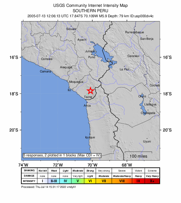
Community Internet Intensity Map - ShakeMap
Vmmi 
Estimated Intensity Map Origin - Review Status
- REVIEWED
- Magnitude
- 5.9 mwb
- Depth
- 79.9 km
- Time
- 2005-07-13 12:06:13 UTC
Moment Tensor Fault Plane Solution View Nearby Seismicity - Time Range

± Three Weeks - Search Radius

250.0 km - Magnitude Range

≥ 2.0
Contributors US

USGS National Earthquake Information Center, PDE