

M 6.9 - 238 km WNW of Naha, Japan
- 2011-11-08 02:59:08 (UTC)
- 27.324°N 125.621°E
- 224.9 km depth
Interactive Map Regional Information Felt Report - Tell Us! 000378Responses Contribute to citizen science. Please tell us about your experience.
- Did You Feel It?
Vmmi 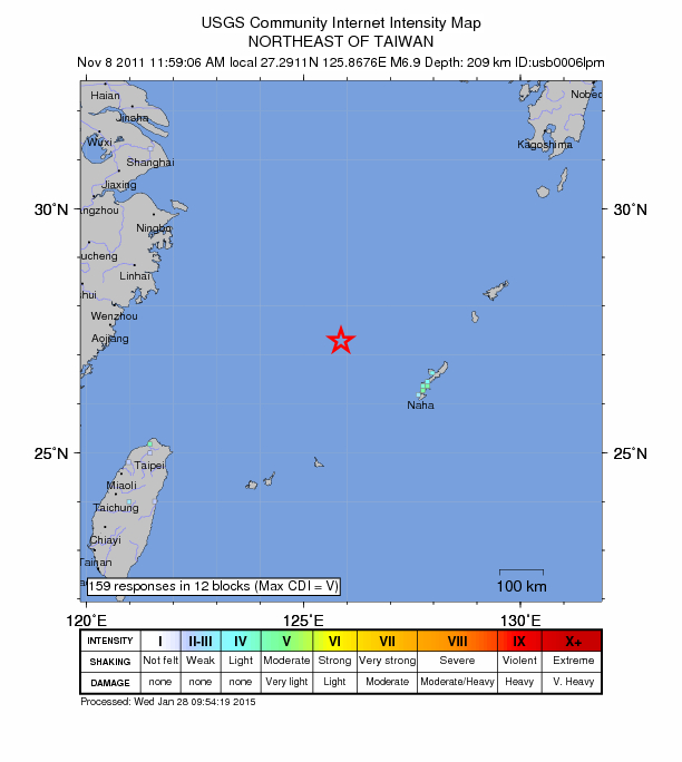
Community Internet Intensity Map Origin - Review Status
- REVIEWED
- Magnitude
- 6.9 mww
- Depth
- 224.9 km
- Time
- 2011-11-08 02:59:08 UTC
Moment Tensor Fault Plane Solution View Nearby Seismicity - Time Range

± Three Weeks - Search Radius

250.0 km - Magnitude Range

≥ 3.0
Contributors US

USGS National Earthquake Information Center, PDE