

M 4.3 - 131 km WSW of Adak, Alaska
- 2016-04-23 23:02:56 (UTC)
- 51.637°N 178.499°W
- 8.0 km depth
Interactive Map Regional Information Felt Report - Tell Us! 000000Responses Contribute to citizen science. Please tell us about your experience.
- Did You Feel It?
Immi Map Information not specified. - ShakeMap
IIImmi 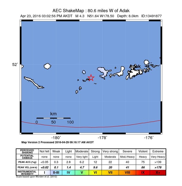
Estimated Intensity Map Origin - Review Status
- REVIEWED
- Magnitude
- 4.3 mb
- Depth
- 8.0 km
- Time
- 2016-04-23 23:02:56 UTC
View Nearby Seismicity - Time Range

± Three Weeks - Search Radius

250.0 km - Magnitude Range

≥ 1.0
Contributors US

USGS National Earthquake Information Center, PDE