

M 2.3 - 2 km W of South Hutchinson, Kansas
- 2017-01-29 03:33:05 (UTC)
- 38.027°N 97.968°W
- 5.0 km depth
Interactive Map Regional Information Felt Report - Tell Us! 000010Responses Contribute to citizen science. Please tell us about your experience.
- Did You Feel It?
IVmmi 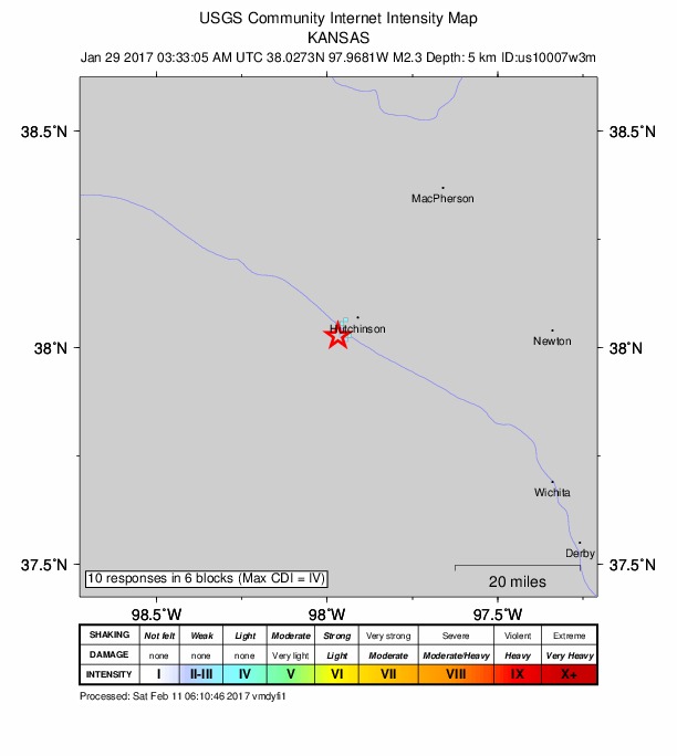
Community Internet Intensity Map Origin - Review Status
- REVIEWED
- Magnitude
- 2.3 ml
- Depth
- 5.0 km
- Time
- 2017-01-29 03:33:05 UTC
View Nearby Seismicity - Time Range

± Three Weeks - Search Radius

250.0 km - Magnitude Range

≥ 1.0
Contributors US

USGS National Earthquake Information Center, PDE