

M 4.5 - 69 km NW of Skwentna, Alaska
- 2016-05-21 11:34:09 (UTC)
- 62.360°N 152.463°W
- 143.5 km depth
Interactive Map Regional Information Felt Report - Tell Us! 000000Responses Contribute to citizen science. Please tell us about your experience.
- Did You Feel It?
Immi Map Information not specified. - ShakeMap
IIImmi 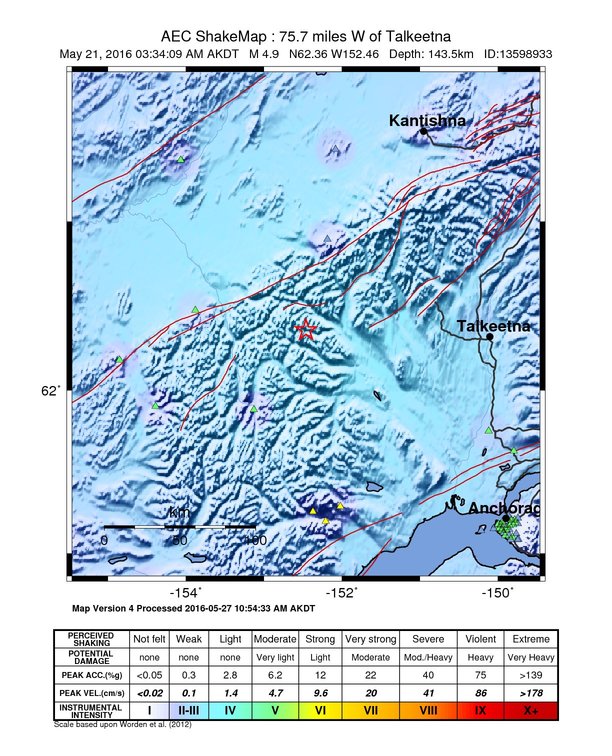
Estimated Intensity Map - PAGER
GREEN 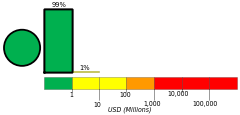
Estimated Economic Losses 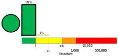
Estimated Fatalities Origin - Review Status
- REVIEWED
- Magnitude
- 4.5 ml
- Depth
- 143.5 km
- Time
- 2016-05-21 11:34:09 UTC
Moment Tensor Fault Plane Solution View Nearby Seismicity - Time Range

± Three Weeks - Search Radius

250.0 km - Magnitude Range

≥ 1.0
Contributors AK

Alaska Earthquake Center