

M 4.5 - 216 km W of Adak, Alaska
- 2016-05-14 15:51:07 (UTC)
- 51.690°N 179.759°W
- 74.4 km depth
Interactive Map Regional Information Felt Report - Tell Us! 000000Responses Contribute to citizen science. Please tell us about your experience.
- Did You Feel It?
Immi Map Information not specified. - ShakeMap
IImmi 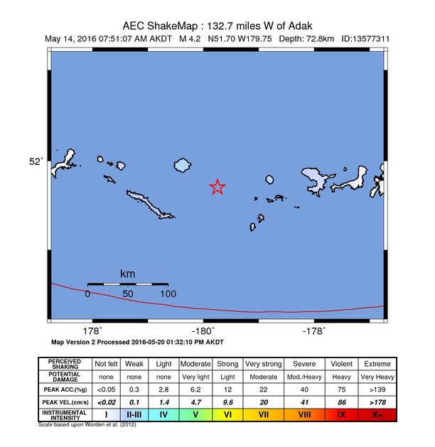
Estimated Intensity Map Origin - Review Status
- REVIEWED
- Magnitude
- 4.5 mb
- Depth
- 74.4 km
- Time
- 2016-05-14 15:51:07 UTC
View Nearby Seismicity - Time Range

± Three Weeks - Search Radius

250.0 km - Magnitude Range

≥ 1.0
Contributors US

USGS National Earthquake Information Center, PDE